Shounter Pass Trek Guide
26th August 2023
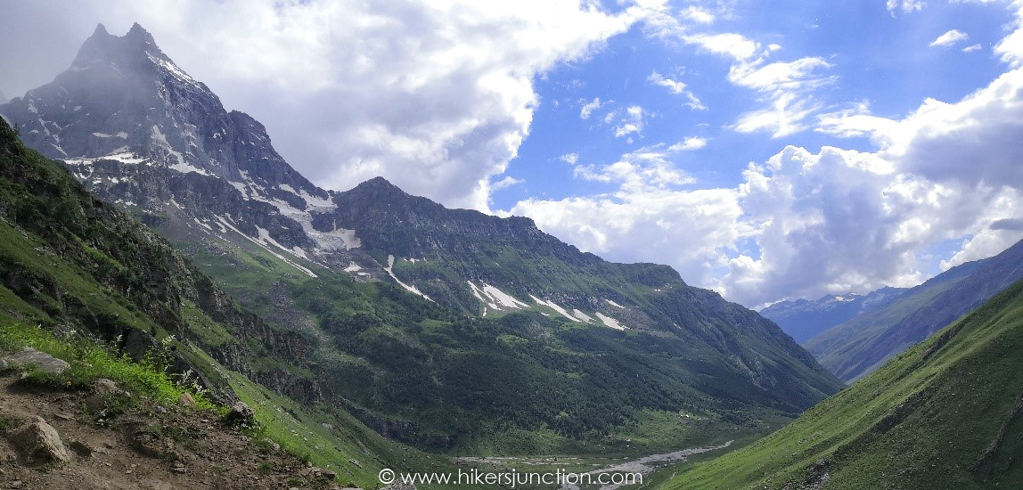
Having visited Neelum valley and the adjacent Shounter valley of AJK in 2009, we had always wanted to revisit the area due to its unmatched beauty. This year we planned to cross the Shounter pass to reach Astore valley in Gilgit Baltistan.
Jump to:
Hike Overview
- Hike Difficulty: Moderate-Difficult
- Trail Length: 17.2km (10.68 mi)
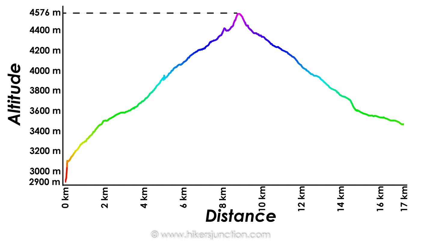
- Elevation Gain: 1,678m
- Typical Hike Duration: 17 Hours
- Trail Head: Shounter Waterfall (Hari Parbat Base Camp)
- Pass Height: 4,576 m (15,013 ft)
- Hike Season: July to September
- Guide: Available from Houz, Upper Domail, Hari Parbat Base Camp
- Porters: Available from Houz, Upper Domail, Hari Parbat Base Camp
Note: Preserving nature is the responsibility of every tourist / hiker. Please DO NOT LITTER, DO NOT DRAW GRAFFITI, DO NOT CUT TREES.
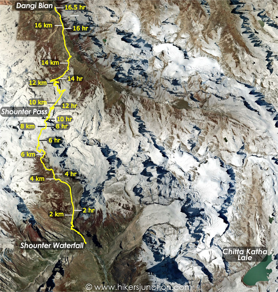
Shounter Pass Map
Trip Overview & Itinerary
| Day | Time | Journey | Duration |
|---|---|---|---|
| Day 1 | 09:30am to 11:30pm |  Islamabad to Kel |
14 hours | Day 2 | 07:00am to 10:00am |  Kel to Houz |
3 hours |
| 11:00am to 04:00pm |  Houz to Dak-2 |
5 hours | |
| Day 3 | 07:00am to 07:00pm |  Dak-2 to Chitta Katha Lake to Houz |
12 hours |
| Day 4 | 08:30am to 11:00am |  Houz to Shounter Waterfall |
2.5 hours |
| 01:45pm to 06:15pm |  Shouter Waterfall to High Camp |
4.5 hours | |
| Day 5 | 06:30am to 07:00pm |  High Camp to Dangi Bian |
12.5 hours |
| Day 6 | 09:00am to 02:00pm |  Dangi Bian to Astore |
5 hours |
| Day 7/8 | 11:00am to 04:00am |  Astore to Islamabad |
17 hours |
Reaching Kel
We took the 9:30 pm coaster to Kel from Pir Wadhai bus stand, terminal No. 22. It is to be noted that direct transport to Kel is only available in the evenings. If you wish to start the journey in the morning then you’ll need to take the coaster from Qadri travels, Faizabad, to reach Muzaffarabad and then find another transport to reach Kel/Sharda.
As we approached Murree it started to rain. At Muzaffarabad it was pouring. The coaster stopped at Muzaffarabad for refueling and that’s where we were struck with the bad news that we’d been praying not to hear. The road just outside Muzaffarabad was closed due to a landslide. We stayed at the fuel station for an hour and a half or so. Some passengers suggested that instead of waiting there we moved to the site of the landslide so that when the road is cleared no more time is wasted. The driver moved on and soon we joined a queue of vehicles waiting for the road to be cleared. A couple of vans were stuck there, trying to cross the loose gravel brought down with the rainwater gushing across the road. Soon a bulldozer arrived and cleared away the slide, also pulling one of the vehicles out of the way. We continued but shortly afterwards we found ourselves at yet another road block. This patch was already being worked on by the same machinery that we’d seen earlier, so were we on our way quickly. We reached Kel at mid day, and booked a couple of rooms in a hotel for the night’s stay.
Here it is pertinent to mention that before attempting Shounter pass we intended to first trek to Chitta Kattha lake. The guide to Chitta Katha Lake helped us a lot in planning our visit to the lake. We had missed a chance to do this trek in our 2009 visit to Shounter valley due to heavy rains and shortage of time. While doing this trek now fulfilled our dream after a gap of 14 years, it also helped us in getting acclimatized to altitudes above 4,000 m and prepared us for the Shounter pass trek.
Jeep to Houz
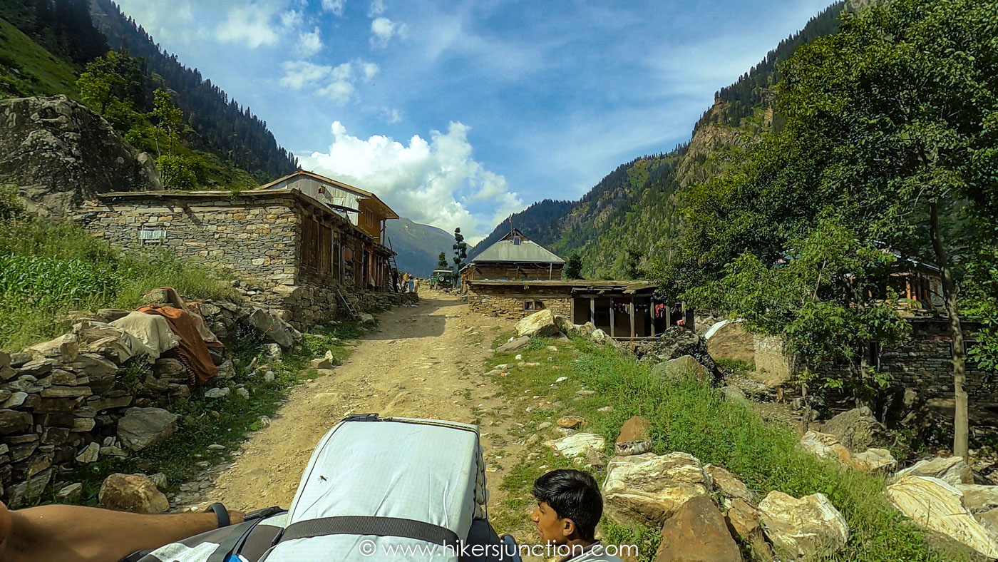
We got on to an early morning jeep from Kel to Lower Domel, and from there we had to change the jeep because of the broken bridge on Shounter Nalla. The jeep on the other side of the Nalla took us to a place called Houz in Upper Domel. Houz is basically the base camp for Chitta Kattha lake trek, comprising a camp site which offers facilities like tents, food and toilet. The camp site is maintained by Zaheer who is a very reasonable and accommodating person.
Hike to Chitta Katha Lake
We stowed our luggage at the camp site, and trekked to Dak-2 the same day with only our backpacks. We stayed the night at Dak-2, and then trekked to the lake and returned to Houz by next evening. One thing that needs to be mentioned here is that now there’s another camp site called Dak-3 on the Chitta Kattha trek, located near the top of the rightmost waterfall just before the final ascent to the lake.
Hike to Shounter Pass
After the night stay at Houz we took the first jeep next morning to Shounter waterfall, which is the starting point for Shounter pass trek, and reached there at about 11 AM. Those going directly for Shounter pass would ride the jeep from Lower Domel (across the broken bridge) all the way to Shounter waterfall. Here the jeep road crosses the bridge over Shounter Nalla, turns right and ends in about 100 m at the Hari Parbat Base Camp, which is a camp site comprising a hotel and a few tents. The trek starts to the left of the bridge.
I must mention that when viewed on Google Earth, the trek looks like a jeep track – and that’s what it is for the most part. It looks as if Shounter valley was connected to Astore through a jeep road at some time, but with the passage of time or the lack of usage the track has disappeared at some places, especially near the top. The track can be used for a gradual climb but short-cuts may be made to reduce the trekking time, though cutting the corners drains the energy more quickly.
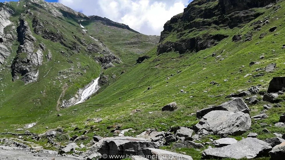
We had to arrange three porters-cum-guides from Hari Parbat base camp. Here first we had to put a great effort to make some locals agree to accompany us, and then had to use all our negotiation skills to make them agree on a reasonable rate. We realized that we would’ve been better off arranging the porters from Houz or Upper Domel. While we waited for our leader to bring the porters, we were given a quick shower by a low passing cloud. After more than two and a half hour’s wait at the camp site, the porters finally carried the two tents, the food stuff, our sleeping bags and any luggage that was heavier for us to carry. At about 1:45 PM we were on our way, with the waterfall to our left. The weather had cleared and the whole landscape was giving a fresh look. The trek climbed quickly, offering some gorgeous views of the valley beneath, and after a couple of hours’ trekking we were at the top of the waterfall at 3:45 PM.

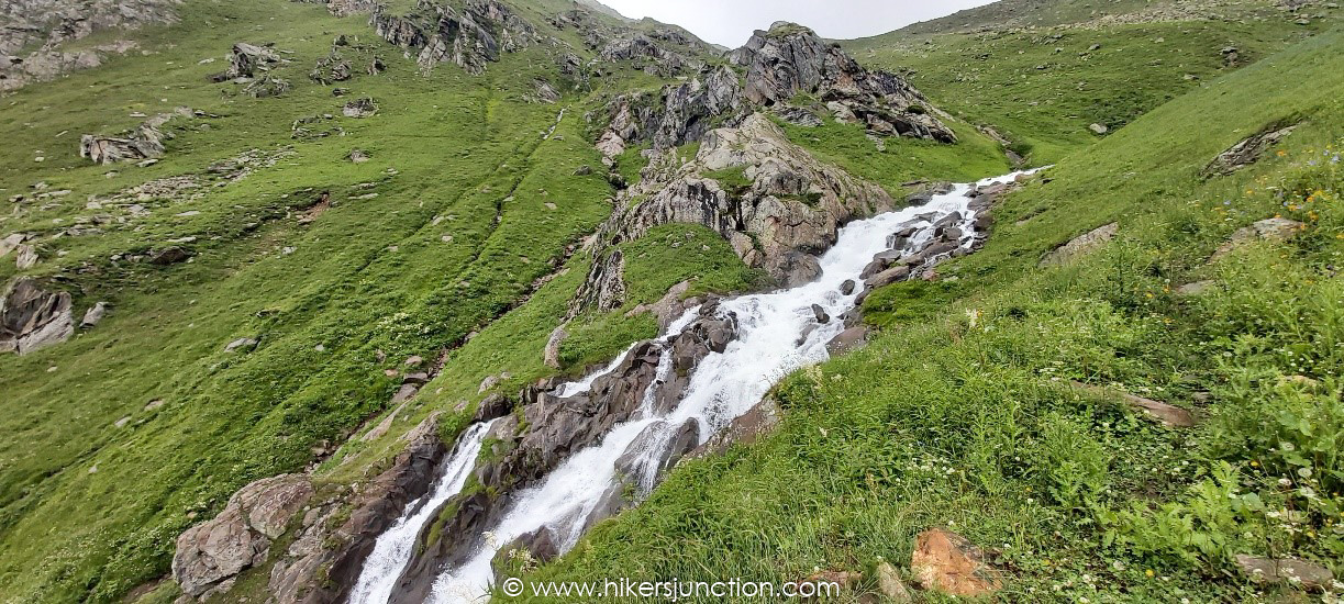
At the head of the waterfall, we had to cross the stream using a structure that resembled a bridge having only the columns but without the beams. The locals have laid stones in the stream in the form of columns, with a space of about a couple of feet between the columns for the water to pass through. For the faint-hearted like me, it was a challenge to forget the water gushing below and focus on stepping on the next stone. After crossing the stream, there’s a small settlement comprising a few mud houses and tents. We had asked the porters earlier if it would be possible for them to arrange roti for us for dinner at high camp. Reaching this settlement, one of the porters said that he lives here and he’ll manage something once he has carried the luggage to the high camp.
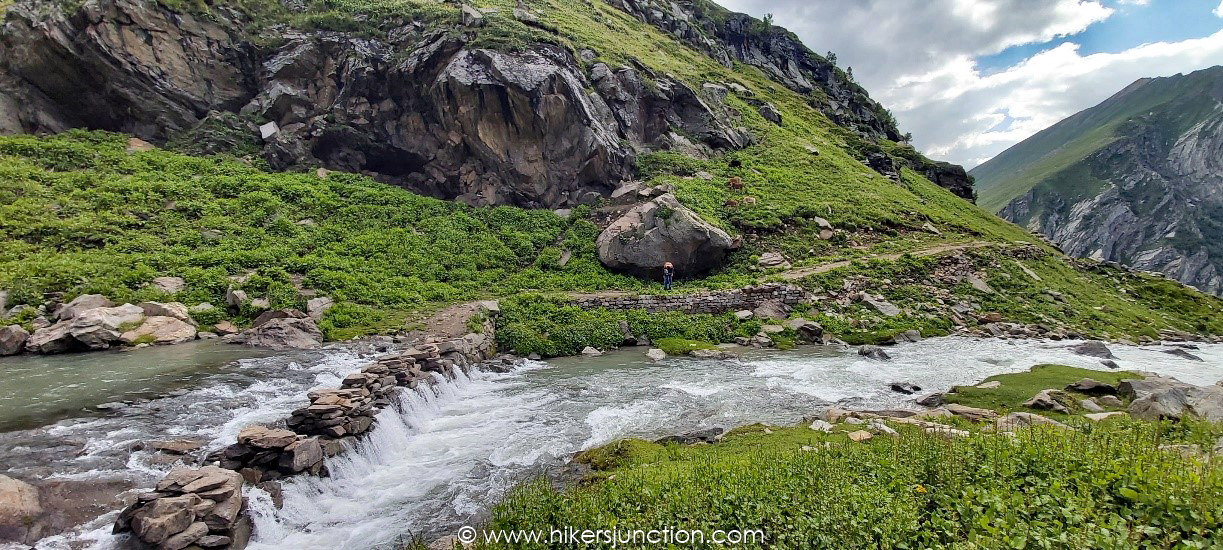
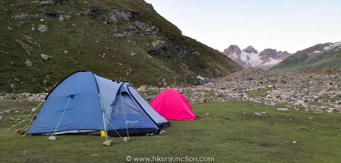
The trek becomes a bit comfortable here, and we steadily and gradually gained height. The views of the valley and the stream to the right are breathtaking, and the pass also becomes visible up ahead. After an hour’s more trekking the porters, which had been running far ahead of us, stopped at a place which they thought was suitable to set up the tents. It was around 4:30 pm, still mid afternoon, so we decided to go further up and ahead so that the next day we could reach the pass as early and quickly as possible. At a distance further up there seemed to be a settlement of some type, and it was decided that we should set up the tents there. Two porters moved ahead while the third one left his backpack there and went down to get the roti. At 6:15 PM we reached the place that we were looking at from beneath. There was no settlement as such but there did exist a patch of land which had been levelled to be used as a camp site. We erected our tents there and made some soup.
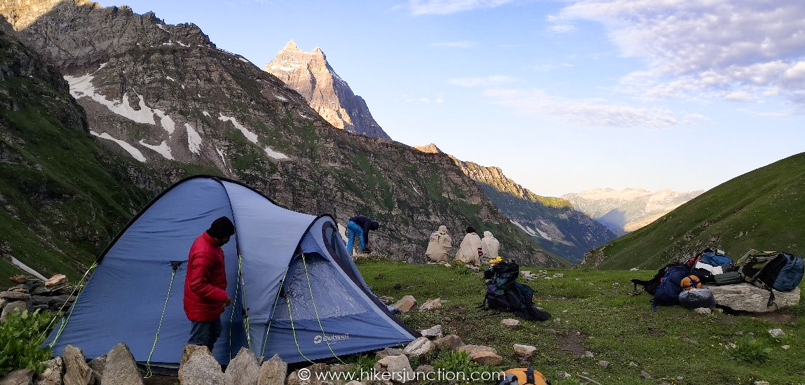
Soon after sunset the third porter brought us a pack which contained wholewheat as well as corn flour rotis! We feasted on the pre-cooked food and rotis, made ourselves some tea and sat outside. It was 13th of moon, the sky was slightly overcast but the whole valley and the surrounding mountains basked in moonlight whenever the clouds made way. The silhouettes of Hari Parbat and the jagged peaks of neighboring mountains drew a dramatic skyline.
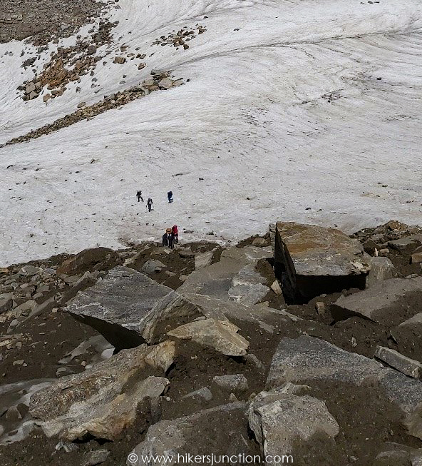
We woke up early the next morning, had a breakfast of roti, chicken spread and honey, packed up the tents and hit the trek again at 6:30 AM. We were again blessed with a bright sunny day and the whole valley beneath was gleaming in the morning sun. Here the trek climbs gradually and soon we crossed a glacier with hard snow. After climbing a bit more we were on to soft snow which slowed us down because every now and then someone would find their leg buried to the thigh in snow. After crossing the patch of snow there came another challenge – loose rock on loose mud! It was really tricky to find a solid foothold to traverse this rocky patch. While the seasoned trekkers among us were able to maneuver this stretch successfully, the others needed the porters’ helping hands to cover the final few treacherous steps. We found out later that one of the members at the end of the pack had slipped on the rocky terrain and another friend saved him from falling further by grasping his backpack. While there wasn’t a risk of life as such crossing that patch, there definitely was a more than mild chance of injury. We all stopped for a while after conquering these hurdles and thought that now it would be only a casual uphill walk to the pass. Hearing this, the porters smiled and this rang an alarm in my mind. To confirm my suspicions, one of the porters pointed his finger at a very steep path which we needed to climb to reach the pass. The trek really looked unclimbable from where we were sitting.
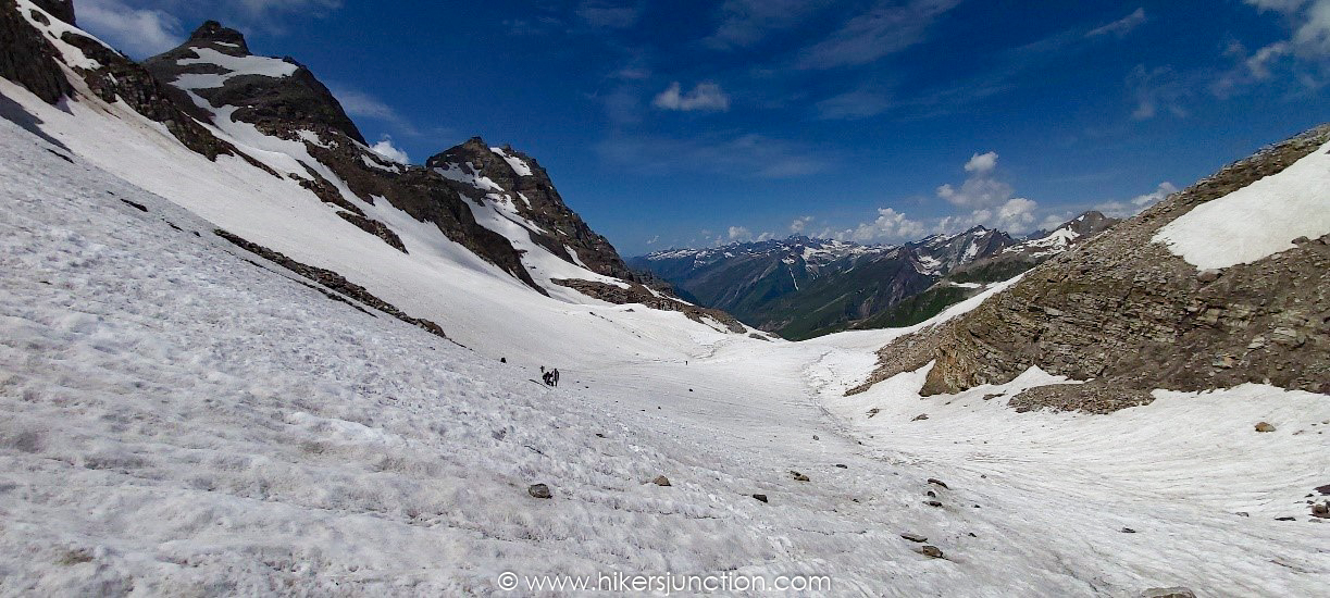
Recomposing and bracing ourselves for this last challenging stretch, we started off on snow again. The porters lead as usual, making footholds in the snow for us to follow. The gradient was about 60 degrees, and with the altitude of more than 4400 m every step and every breath was becoming a battle. Eventually we were past the snow patch and traversing rock and mud again. At some points we had to scramble on all four to maneuver the steep ascent. Using the last shreds of willpower we were finally at the pass at 11:30 AM, looking over to the valley on the other side.
We all praised and thanked Allah, embraced one another, and freed ourselves from the weight of backpacks. The kitchen was set up at once and we had some well-deserved and much-needed tea.
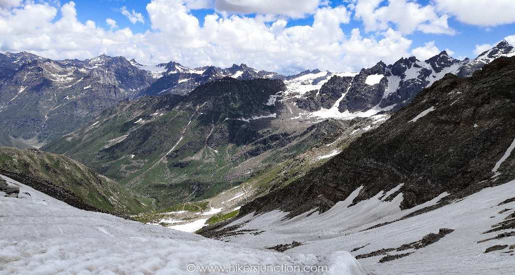
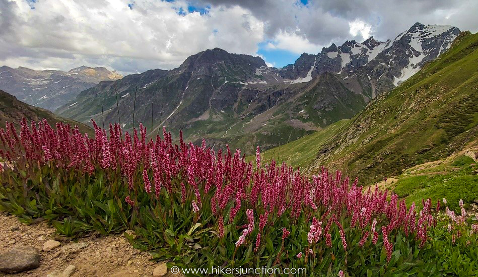
After staying for almost two hours at the pass, taking photographs with the National flag and absorbing the majestic views of valleys on both sides, we started our descent at 1:20 PM. For the initial twenty minutes or so we were on snow which soon led to a jeep track which we followed for most part. At some places we opted for short-cuts to shorten the trek. The never-ending melodious sound of streams crisscrossing the trek, beds of wild flowers, and views of valley below and snow capped peaks above made this a very soul enriching experience. Behind us, to the left, was a sheer drop of a couple of hundred feet with waterfalls galore that reminded us of the waterfalls we had seen just a couple of days ago on the way to Chitta Kattha lake.

We were hit by rain as we were descending, but fortunately we had reached a gradual slope so our pace wasn’t affected much. Here we met a couple of shepherds whom we requested to go ahead and find a jeep to take us to Astore. The nearest village was a shepherds’ summer settlement by the name of Dangi Bian but the jeeps were only available at Mir Malik, which was another 14 km or so ahead. To get the jeep to come and pick us up from Dangi Bian, the jeep driver had to be contacted on the mobile phone but Daas, the nearest place where mobile signals could be caught, was another 2 or 3 km further away from Dangi Bian.
The shepherds shot off and were out of sight in a matter of minutes. We continued downhill and soon found ourselves at a stream with heavy water flow. We were not able to judge the depth of the water midstream either. Each of us was helped by a porter to cross the stream one by one. The water was thigh deep midstream for a few steps and we were able to cross the stream quickly.
The sun had went behind the mountains and it had become dark when we reached Dangi Bian. Some of our team members went to the settlement to find a way for us to get to Astore. To our delight we saw a jeep parked beside a house which we thought we should be able to book and ride our way to Astore. It was learnt that the jeep belonged to the Chairman of the area but the driver was asking for a ridiculous amount to get us to Astore. In the meantime the shepherds that had gone to get the jeep also turned up and told us that the drivers were returning to Dangi Bian on motorbike with their jeeps parked in Ali Malik. Soon the drivers arrived but negotiations with them for the next day’s visit to Astore were not fruitful and no agreement could be reached on the fare. Other locals gathered and recommended that we set up our camp and stayed the night at Dangi Bian. One local, Bashir, was particularly hospitable and he told us that once we set up the tents he’d come with roti, tea and any other thing that we may need. It wasn’t long before we were in our tents having meal with the fresh roti brought by Bashir. We were not finished with the dinner when fresh, hot milk was served. I am not fond of milk but the fresh fragrance emanating from the kettle made me take a sip. I ended up drinking two cups! That milk greatly helped in replenishing our energies after a tough day. Shortly afterwards Bashir brought us tea. He asked if we needed anything else. We requested him for some mattresses for the porters since they were sleeping in the tent that we had brought but they only had mats without any sleeping bags. Bashir was kind to get some bedding for them. We were really humbled by the locals’ generosity and hospitality.
Early next morning, before sunrise, our quickest member took off on foot towards Daas for making a call to another jeep driver whose mobile number was given to us by someone in Houz. He was gone for more than three hours when we finally decided to pack up the tents and get going towards Daas instead of waiting at Dangi Bian. We had trekked for only a short while when we got the mesmerizing view of a jeep coming towards us. In a matter of minutes we were aboard the jeep with our stuff loaded on the top. We all hailed our friend for taking the initiative and walking for miles in search of a signal to be able to contact the driver. We reached Astore at mid day and found ourselves a hotel. We stayed the night at Astore, made a day visit to Minimarg and Rainbow lake the next day, and were on the bus to Rawalpindi the day after.
Recommendations
Now I’ll make a few recommendations based on our experience. First, at least one group member should have a Ufone sim. This will be helpful because in AJK there’s only one mobile network, S-COM, and Ufone sim is automatically connected to S-COM through roaming. Please bear in mind that Ufone sim can only be used for voice and text services, not for Internet access. You’ll get mobile signals up to Kel; the next place where you get mobile connectivity is at Daas, 2 or 3 km after Dangi Bian. In Astore, however, all major mobile operators are active, and you’ll be able to get Internet connectivity as well (Edge only, no 4G).
Secondly, the porters must be arranged from Houz – do not delay it until Upper Domail and certainly not until Hari Parbat Base Camp! Thirdly, pre-arrange a jeep to pick you up from Dangi Bian – you may be able to save a whole day!
Other Hikes
Check out similar blog posts on many other hikes here.
Equipment
Having the right equipment and gear is essential for an enjoyable hiking experience. Check out the list of recommended hiking gear.


