Chitta Katha Lake Trek Guide
15th July 2022
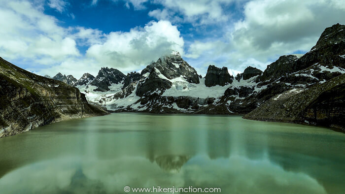
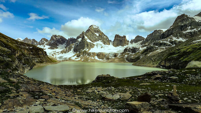
Chitta Katha Lake was on my bucket list for several years. The pictures I had seen of this lake with the jagged mountains at its backdrop, and the tales I had heard of it being one of the most beautiful treks were the reasons this hike was at the top of my list. For one reason or another, this trek evaded me for years. In summer of 2022, me and one of my friends were determined to do the Chitta Katha Lake tour. The only problem was that the only opportunity we had was during Eid-ul-Adha holidays.
We decided to partially sacrifice Eid and 'hopefully' return by the 2nd day.
Jump to:
- Hike Overview
- Chitta Katha Lake Map
- Trip Overview
- How to Reach
- Hike to Chitta Katha Lake
- Camping
- Final Thoughts
- Trail Video
- Equipment
Hike Overview
- Hike Difficulty: Moderate-Difficult
- Trail Length: 8.6km (5.4 mi)
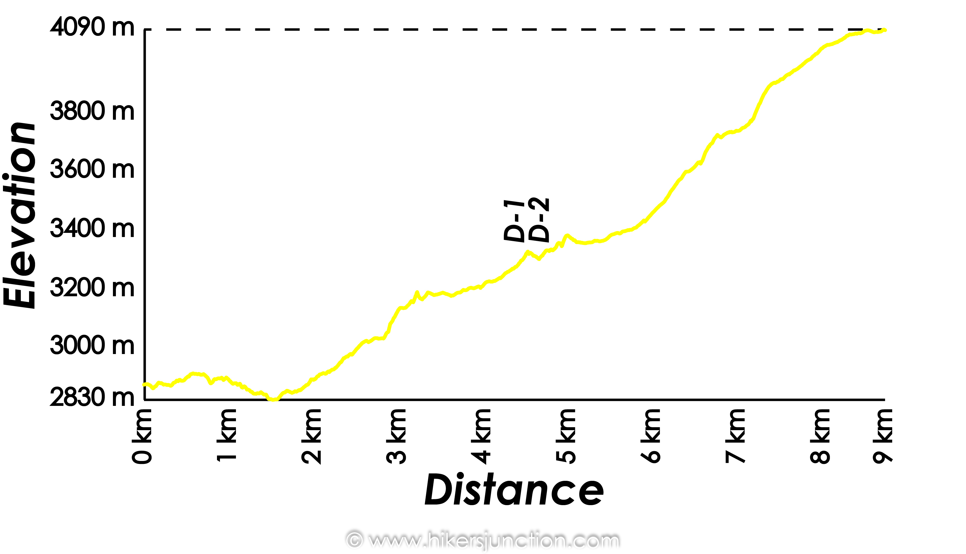
- Elevation Gain: 1,260m
- Typical Hike Duration (One-way): 8 Hours
- Trail Head: Houz or Upper Domail
- Chitta Katha Lake Height: 4,090 m (13,420 ft)
- Hike Season: July to October
- Campsite: Dak-1 and Dak-2
- Guide: Available from Houz, Dak-1 & Dak-2
- Porters: Available from Houz, Dak-1 & Dak-2
- Car Parking: Available at Kel
Note: Preserving nature is the responsibility of every tourist / hiker. Please DO NOT LITTER, DO NOT DRAW GRAFFITI, DO NOT CUT TREES.
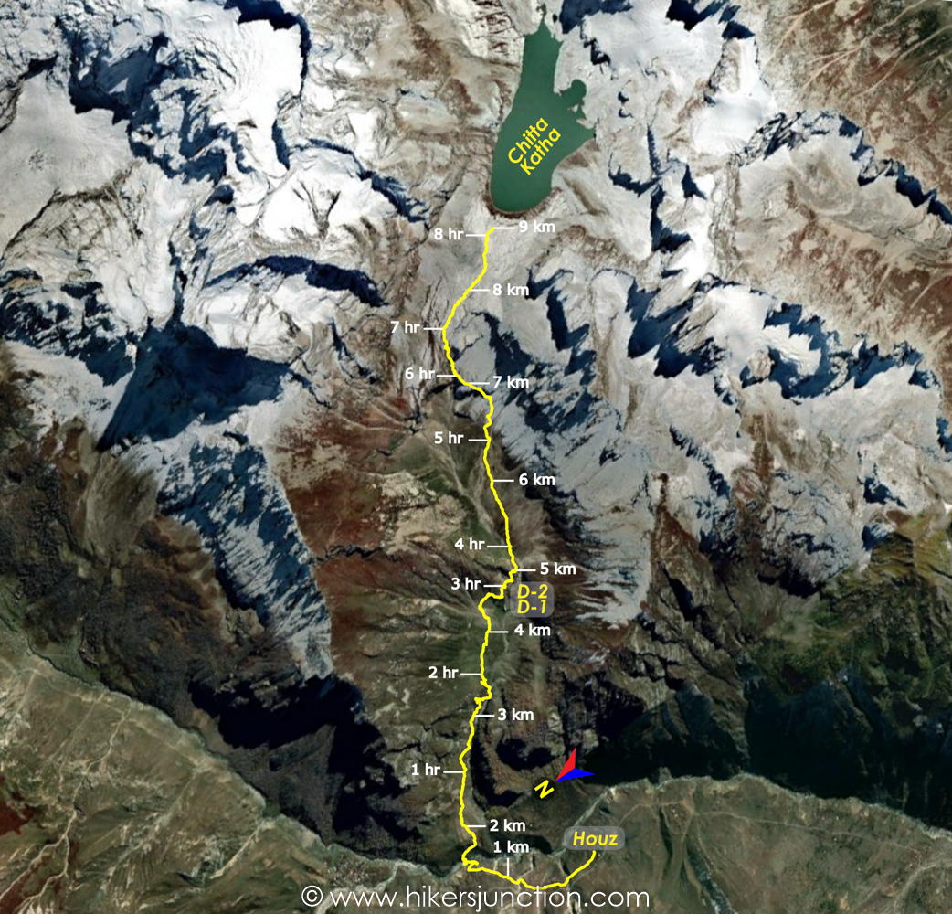
Chitta Katha Lake Map
Trip Overview & Itinerary
| Day | Time | Journey | Duration |
|---|---|---|---|
| Day 1 | 06:00pm to 01:00am |  Islamabad to Keran |
7 hours |
| Day 2 | 07:00am to 12:00pm |  Keran to Kel |
5 hours | 02:00pm to 04:00pm |  Kel to Houz |
2 hours |
| Day 3 | 07:00am to 10:00am |  Houz to Dak-2 |
3 hours |
| 10:30am to 03:30pm |  Dak-2 to Chitta Katha Lake |
5 hours | |
| Day 4 | 07:30am to 01:00pm |  Chitta Katha Lake to Houz |
5.5 hours |
| 03:00pm to 05:00pm |  Houz to Kel |
2 hours | |
| 05:30pm to 09:00pm |  Kel to Keran |
4 hours | |
| Day 5 | 09:00am to 04:00pm |  Keran to Islamabad |
75 mins |
Reaching Kel
Chitta Katha Lake's location is in Shounter valley which is near Kel, the 2nd to last town in Azad Jammu and Kashmir. If you search for directions to Kel on Google Maps, it will show a route through Naran and Jhalkhand. This is 100% misleading and incorrect. The only route to Kel on a car is through Muzzafarabad, Keran, Sharda and so on.
We set off for Kel from Islamabad on Thursday evening after work. We stopped for an underwhelming dinner at OPTP in Murree, and continued forward towards Muzzafarabad. We got as far as Keran before calling it a night at 1am. We found a cheap hotel for staying overnight.
Next morning we got breakfast at a dhaba and carried on our journey towards Kel. The road onwards from Keran was in pretty bad shape, but luckily our Suzuki Cultus had just enough ground clearance to make it through.
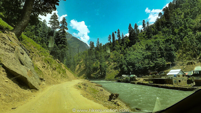
We considered parking our car at Sharda and taking public transport from there, but we were unsure when we would get the next transport to Keran. Even more importantly, we were not sure how we would reach Sharda on the way back since it would be Eid Day then.
We opted to carry on and reached Kel at around noon time. We found a place to park our car and inquired about the jeeps that go to Upper Domail in Shounter Valley which is the starting point for the trek.
Jeep to Houz
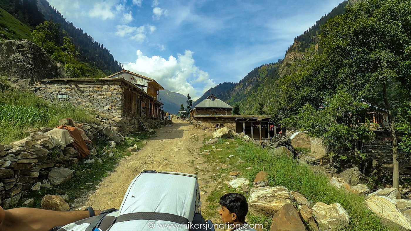
We found a public transport jeep that would take us to our destination. The cost was Rs. 400 if you wanted to sit inside, and Rs. 300 if you want to sit on the roof. Because we were real cheapskates, we opted to save a Rs. 100.
The roof of the jeep was not a nice place. We were surrounded by cardboard boxes containing live chickens, which I guess the locals were taking up to their villages for Eid feasts. There were other people with us on the roof, and their luggages. Our huge rucksacks were also on the roof. There was nowhere for our legs so we hung them off the side of the jeep, which was uncomfortable as well because of a metal bar under the back of our knees.
There was a little bit of confusion regarding our destination as well. Domail, and even Upper Domail have several meanings in that area. In the end our destination turned out to be a place called Houz.
The jeep journey took just over 2 hours. The jeep stopped numerous times along the way, with people getting off and getting on regularly.
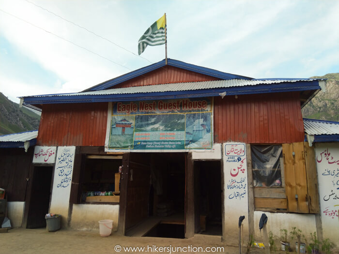
We reached Houz by evening. This is where our travel on wheels came to an end. Chitta Katha Lake's distance from Islamabad on-road ended up being about 330km. At Houz, there was a campsite, a small masjid and a guesthouse with a kitchen and a shop. We pitched our tent just outside the guesthouse for the night.
Hike to Chitta Katha Lake
The next morning we woke up to the sound of rain. We had expected to run into rain sooner or later because it was monsoon season. We prepped for the hike and got going in the rain at around 7am. Although both of us had watched plenty of Chitta Katha Lake guide videos on Youtube and even tried to track the Chitta Katha lake route map on Google Maps, we still considered it wise to hire a guide anyway.
From Houz the main jeep path goes to Upper Domail whereas a smaller trail going downhill is the route to the lake.
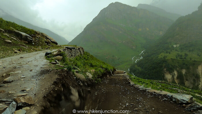
We hiked downhill on this trail to cross the Shounter Nala which we had travelled along from Kel. Immediately after we entered into a small village. There were a number of trails in the village, having a guide here was useful because he knew the right way through.
A little while later we were through the village and on the trail to Chitta Katha Lake. Luckily the rain had also stopped by then.
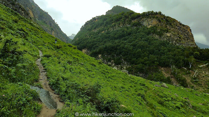
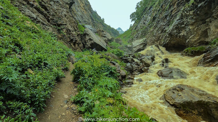
We trekked alongside the Chitta Katha Nala which is known to be really white, but for us it was brown in colour due to the rain. The trail runs very close to the Nala and eventually at one point it basically merges with the Nala where you have to hike up the edge of the Nala. A little while later you climb up and away from the Nala by climbing up a very steep slope.
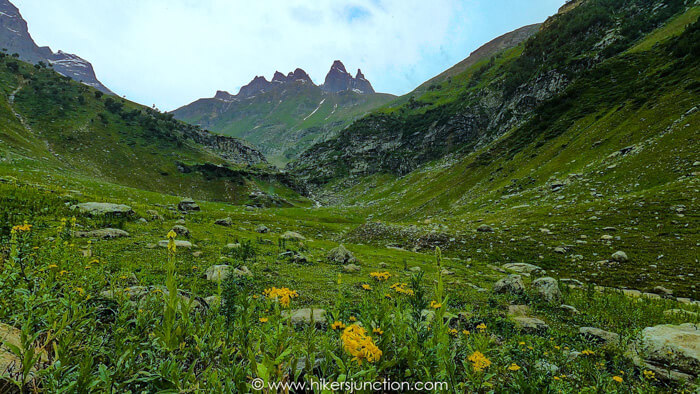
We eventually reached a large plateau from where the campsites of Dak-1 and Dak-2 were visible. We used to think that these campsites are far apart, but in reality they are only a minute or so away from each other. I'm not really sure why they even have different names to be honest.
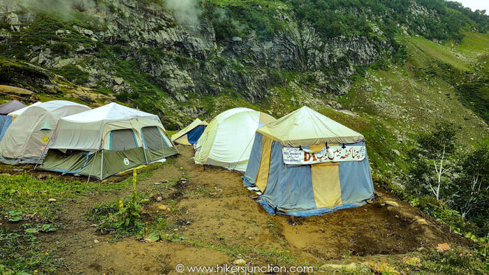
Available Facilities at Campsite
| Facilities | Availability |
|---|---|
| Tents |  |
| Water |  |
| Food |  |
| Toilet |  |
| Phone Signals |  |
We stopped at Dak-2 for some refreshments and to also inquire about the route forward. Usually people camp at Dak-1 or Dak-2. They then go up to the lake and back the next day. It was around 10am when we reached the campsites so there was no question about camping here. The only option was to go to the Lake which would mean that we would have to camp by the lake.
The locals at the campsite were really not happy with our idea of camping by the lake. They told us all sorts of stories to try and scare us. From unpredictable weather at the lake, to stories of people getting lost on the way back, to even tales of wild beasts and even supernatural beings (Jinns!). They were quite compelling in their tone so we were not sure whether they are genuinely concerned or they're just trying to get us to stay so that they get some business out of us. I should also mention that since it was Eid time, we were the only two people on the entire trail. So in case any of what they said was going to be true, then we would be in a fair amount of trouble because there was no one else visiting Chitta Katha Lake during those days.
Eventually, we offered to give them in writing that we were solely responsible for camping at the lake. We wrote a little note, signed it off and handed it to them.
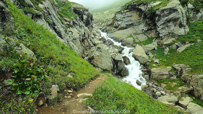
For the next part of the hike we hired two porters from Dak-2 to carry our rucksacks. The guide who came with us from Houz was a young boy who we sent back. A little while ahead of the Dak-2 campsite we climbed through some large boulders to come up to the Dak-2 plateau. This was probably the first time on the trek when my jaw absolutely dropped. The view of the plateau from its edge where we were standing was one of the most amazing views I had ever seen in my life.
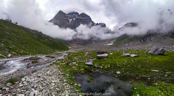
The clouds were low. Right in front of us was the Hari Parbat mountain. There were at least 3 waterfalls coming down from Hari Parbat and another 2 or so coming down from our right. The awe of that view can neither be described nor showed in any picture or video.
From this point onwards the grandeur of the hike to Chitta Katha became truly apparent. We crossed another bridge and proceeded forward.
We started our gradual ascent towards the right edge of the Hari Parbat. We got closer to the waterfalls and stopped many times to absorb the views around us.
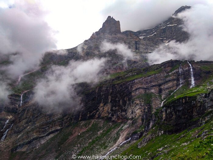
The route up to the lake goes right beside the Hari Parbat waterfall which is the rightmost waterfall coming from Hari Parbat. The part of the trail where you are trekking towards the Hari Parbat waterfall, surrounded by red and blue flowers is definitely the best section of the hike.
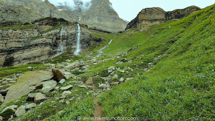
But, the fun times stop there. What comes next is a brutal ascend up by the waterfall. At this point you are already at an altitude of over 3,700m ASL (above sea level), and you're supposed to rapidly gain 200m more in about half a kilometer. For perspective, thats like going halfway up Islamabad's Trail 3 or Trail 5 in a distance of 0.5km instead of 2.5km, whilst starting off from 3,700m ASL, instead of 500m ASL. Point is, this stretch is ridiculously steep and very high.
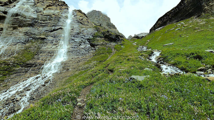
It took us over an hour to ascend the 200m covering 0.5km of the trek. We were almost at 4,000m, the oxygen level was down to 13%. All that exertion coupled with the low oxygen was making me feel like throwing up. At long last the trail flattened out a little bit. We were almost at the lake at this point, the peaks of the jagged mountains behind the lake were starting to come into view. But, the motivation to reach the long-awaited Chitta Katha Lake did not overcome the need to take a rest. My hiking buddy took it a step further and fell asleep.
We got going again for the final stretch of the hike. We crossed over some snow patches and finally at around 3pm we set our sights on the majestic, the fascinating and the brutal Chitta Katha Lake.
Camping
The porters that came with us setup our camp and then left us to head back down to Dak-2 before dark. I was so tired and unwell after the hike that I didn't care much about taking pictures instead I got into the camp to take some rest. After a while, just before sunset I was feeling a little bit better so I got out to enjoy the lake, take some pictures and realise that this was definitely the most amazing place I had ever camped on.
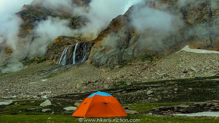
As darkness fell, Chitta Katha Lake's temperature fell to under 10°C. We got back inside the camp, had an exquisite dinner of quick noodles cooked on our portable stove, and went to sleep. In the middle of the night I felt ill again. I bolted out of my sleeping bag, pulled my head out of the camp just in time before throwing up. Other than that the night passed away eventless. No wild beasts, no paranormal activity.
The next morning we got up early. Chitta Katha Lake's weather had changed overnight. There was a lot of fog around and the lake was barely visible. We had some breakfast, packed up our stuff, had one more look at whatever was visible of the lake and left. The fog was so dense that retracing our steps was a little bit tricky. Still, we knew there was only one way down and we found it fairly easily.
We descended all the way down to Dak-2 in a matter of a few hours. It was Eid day so we greeted the folks at Dak-2 who were happy to see us. We gave them all of our leftover food since it was of no use to us anymore and continued back down. Even the descend was a bit tricky at points, particularly near the steep section of Chitta Katha Nala.
We reached back to Houz around midday. Since it was Eid day, the usual transport to Kel was off duty. We had to wait for several hours before we eventually found a jeep going down. We hopped onboard and reached Kel by evening.
We drove till Keran before getting a hotel. The next morning I took a well deserved shower and continued the journey back to Islamabad.
Throughout the trip the food we ate was pretty ordinary to say the least. The burgerboy inside was craving for a nice burger ever sine OPTP let us down on the way to Neelum Valley. Hence to fulfil the urge, we stopped over at McDonalds Murree and got ourselves a fulfilling Double Big-Mac before heading home to conclude the trip to Chitta Katha Lake.
Final Thoughts
Chitta Katha Lake is Kashmir's second best lake in my opinion, but its hike is definitely the best. It is beautiful because of its greenery, the flora and fauna, the waterfalls and the lake itself. The trek is only about 9km long, though others on the internet have quoted much longer distances. I am certain that it is 9km at most since I recorded the trek on Alltrails app on the way up and also on the way down. What makes this trek challenging is its elevation gain of 1,260m in such a short distance. The engineer inside me did a bit of trigonometry and calculated that the average gradient of this trek is 9°. That is a significant value for an 'average' gradient. But despite its challenge I would still go to Chitta Katha again if given the chance because it is well worth it.
Trail Video
Other Hikes
Check out similar blog posts on many other hikes here.
Equipment
Having the right equipment and gear is essential for an enjoyable hiking experience. Check out the list of recommended hiking gear.


