Trek to Haramosh Valley & Kutwal Lake
30th June 2019
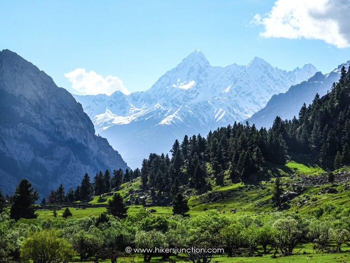
My Haramosh valley tour in July 2019 was a particularly memorable one. I did not know much about this trek but since a few of my friends were going, I decided to join them. Little did I know that this trip would have me trekking through some of the most picturesque valleys in the Gilgit Baltistan, hiking through diverse terrains with ever-changing views in a relatively short hike.
Jump to:
- Hike Overview
- Trip Overview
- How to Reach
- Hike to Kutwal Village
- Camping
- Hike to Kutwal Lake
- Equipment
Hike Overview
- Hike Difficulty: Moderate
- Trail Length : 19 km (12 mi)
- Typical Hike Duration (One-way): 8 to 11 Hours
- Trail Head: Dasu
- Kutwal Lake Altitude: 3,310 m ( 10,860 ft)
- Hike Season: June to October
- Campsite: Kutwal Village
- Guide: Available from Sassi
- Porters: Available from Sassi
- Car Parking: Available at Sassi
Note: Preserving nature is the responsibility of every tourist / hiker. Please DO NOT LITTER, DO NOT DRAW GRAFFITI, DO NOT CUT TREES.
Trip Overview & Itinerary
| Day | Time | Journey | Duration |
|---|---|---|---|
| Day 0 / Day 1 | 10:00pm to 03:00pm (+1) |  Islamabad to Sassi (via Babusar) |
17 hours |
| 10:00pm to 08:00pm (+1) |  Islamabad to Sassi (via KKH) |
22 hours | |
| Day 2 | 08:00am to 09:15am |  Sassi to Dasu |
75 mins |
| 10:00am to 04:00pm |  Dasu to Kutwal Village |
6 hours | |
| Day 3 | 07:00am to 09:00am |  Kutwal Village to Kutwal Lake |
2 hours |
| 09:30am to 12:00pm |  Kutwal Lake to Base Camp |
2.5 hours | |
| 12:30pm to 04:00pm |  Base Camp to Kutwal Village |
3.5 hours | |
| Day 4 | 07:00am to 11:00pm |  Kutwal Village to Dasu |
4 hours |
| 11:30pm to 12:30pm |  Dasu to Sassi |
75 mins | |
| 02:00pm to 07:00pm |  Sassi to Chilas |
5 hours | |
| Day 5 | 08:00am to 08:00pm |  Chilas to Islamabad (via Babusar) |
12 hours |
| 06:00am to 11:00pm |  Chilas to Islamabad (via KKH) |
17 hours |
Reaching Haramosh Valley
Haramosh valley's location is somewhere between Gilgit and Skardu. It is accessed from a small village called Sassi, located on the Gilgit-Skardu road. My Haramosh valley trek was managed by a group touring company with whom this trip would be my first and my last. Our reporting time to Faizabad was 10pm, but we did not set-off till 1am in our Toyota Coaster. We travelled overnight and then all through the day to reach Sassi by evening the following day where we stayed overnight.
All-in-all, Haramosh Valley's distance from Islamabad is 492 km on the Babusar route and 583 km on the Karakoram Highway (KKH) route. Some of the members in the group were travelling from Lahore. They would end up covering the Lahore to Haramosh valley distance of a whopping 837 km!
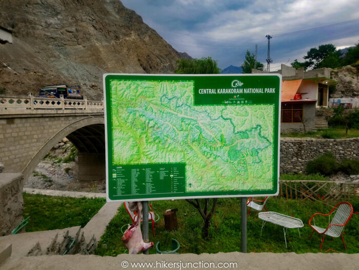
Jeep to Haramosh Valley
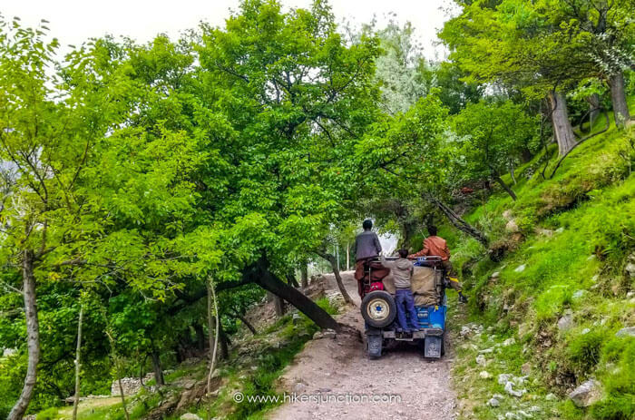
The next morning jeeps were ready outside our hotel which would take us to the trailhead (starting point). Although jeep rides in Pakistani mountains are rarely enjoyable, this one was an exception.
The Haramosh Valley road initially started off as a treacherous path, but it soon turn into a pleasant ride through beautiful mountain villages. There were abundant blueberry and apricot trees along the route and because we were in open-top jeeps, we were able to pick fresh blueberries and apricots straight from the trees without even stopping.
After about 75mins in the jeep, we reached the trailhead at Dasu.
Trek to Kutwal Village
We disembarked from the jeeps, and carried on forward on the same path. The wide jeep track gradually became narrow into a pedestrain trail. On our right was a small water stream flowing to the villages below.
Verly early on the trail we came across a waterfall on the right. Soon after there was a short 50m long section which was prone to rock sliding. We had to run across this patch one-by-one.
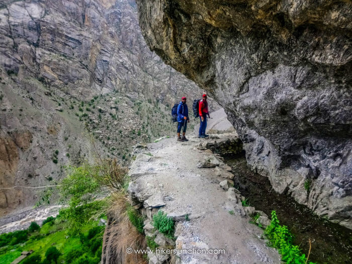
The trail first lead to Iskere village. Locals of the village went about their daily chores as we hiked through their beautiful village which had many fruit bearing trees.
Even in July, we had to cross a couple of snow patches along the trail. These had to be crossed with great care because a slip here could be very costly.
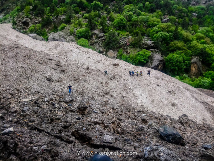
We kept following the trail across the regularly changing sceneries. At one point, we had to cross over a raging water stream using a wooden plank that served as a makeshift bridge.
Camping
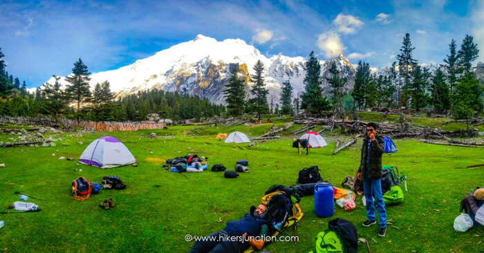
After hiking for about 5 to 6 hours, the trail became flat and we reached a series of beautiful open meadows. After about another hour or so, we reached the campsite which is located next to the very small Kutwal village. This is where we camped for the night. There were no facilities available at the campsite so you must bring all camping gear with yourself. Ice cold water was available from a small water stream running along one side of the campsite.
The campsite offered great views of several surrounding snowcapped peaks such as the Haramosh Peak, Bilchar Dobani and Laila Peak (haramosh valley) .
Available Facilities at Campsite
| Facilities | Availability |
|---|---|
| Tents |  |
| Water |  |
| Food |  |
| Toilet |  |
| Phone Signals |  |
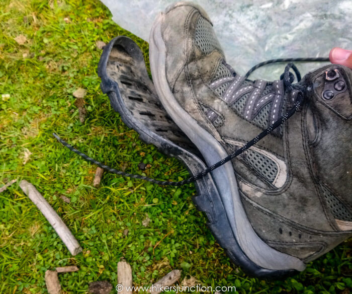
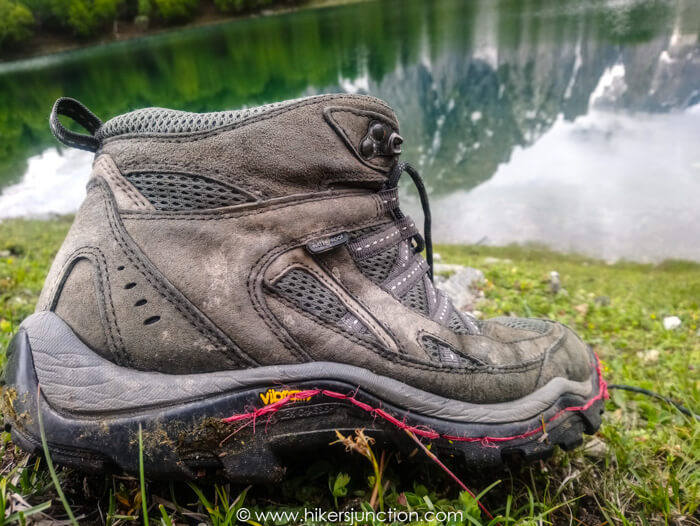
Just after reaching the campsite, a calamity hit me in the shape of the entire sole of my right shoe coming off all at once. This was very concerning for me since I was deep into wilderness with a torn shoe, far far away from a mochi (cobbler). Luckily, one of the locals named Alif Shah saw me in my dilemma and offered to help me. He had a cobblers's needle, a thread of sorts, and the skills to mend the shoe. The following day the sole of my other shoe would come off as well and once again Alif Shah came to the rescue. I was incredibly thankful of him and I made sure to give him a good monetary reward for his help.
At the campsite one of the hikers asked some locals for some local milk, which they happily brought for us. This would probably be the purest milk one could ever find so I decided to have a go as well. It was only after I had drank a cup that they mentioned that they hadn't boiled the milk. Not surprisingly, that night I became a little sick.
Kutwal Lake Trek
The following morning I was feeling better. We left our rucksacks in the tents, packed some food items and warm clothes in a smaller bag and continued our hike towards Kutwal Lake which was located a further 2 hours away.
The hike from the campsite to the lake was the climax of the entire trip. The views changed after about every 20 mins or so. The most jawdropping section was one where we trekked through a vast open green meadow bordered by the dark grey of a huge, incredibly close mountain.
A little while later we found ourselves in a forest where the trees were constantly emanating little particles off into the air, creating an almost magical environment.
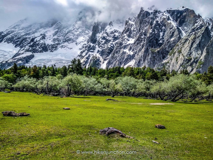
After passing the trees we gained some elevation. Here, if you turn around and look the way you came, you will see the meadows and the tree patch and the magnificent Bilchar Dobani (6,143 m) in the backdrop. The enormity of the mountain makes this scene indescribably mesmerising.

The final approach to the lake consisted of a gradual climb. The lake came into view down below a steep slope. The lake did not have any inflow or outflow, and hence seems to be the result of precipitation alone. Kutwal Lake's weather wasn't very cold since Kutwal Lake's height is 3,310 m, which is relatively low as compared to some of the other lakes which I have trekked to.
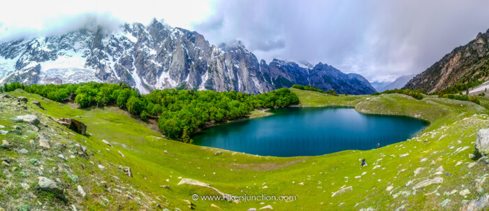
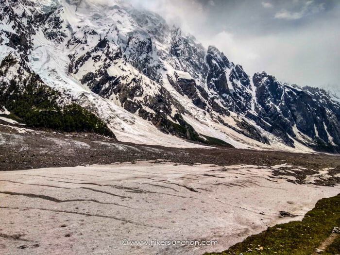
The scenes that we trekked through to reach the lake were so amazing that the lake itself did not seem as appealing in the end. We hiked beyond the lake as far as we could till we reached an enormous glacier at the base of a mountain.
On the way back some locals again offered us some milk, which I again consumed. Upon reaching the campsite at the end of the day I was incredibly hungry. But dinner was nowhere on the horizon because the organiser decided to slaughter a local goat and cook that instead. They started the process at 6pm and it was no surprise that the food wasn't ready till 11pm. By that time I had enough and I went to sleep on an empty stomach. Here I learned an important lesson which was that you should always carry a portable stove and food items with you which allow you to cook independently and eat what you want, when you want.
The next morning, the previous day's exertion coupled with not having dinner and drinking unboiled milk, twice, caused me to have diarrhea. The organiser had given a departure time of 8am but they were not ready to actually leave till 10am. On top of this, they decided that we would return to Dasu on an alternate path through the Mani glacier, which I later realised was much longer than the route we took to come up a few days ago. I toiled through the day, being incredibly sick, eating imodiums like toffees to eventually reach Dasu after what seemed like forever.
We reached the jeeps near dusk. The group was travelling on two jeeps. Mine was in front and I happended to unknowingly drop my wallet from the jeep. The jeeps stopped suddenly and the driver of the rear jeep got off and handed me my wallet for which I was very thankful. We reached back to our hotel at nighttime and the organiser wanted us to have dinner so that we could leave for Chilas at night where he had booked the night stay.
I heavily objected to the idea of travelling at night since we were only late because of his lack of punctuality and planning, otherwise we would've covered most of the distance to Chilas during daytime. It was eventually decided that the night will be spent at Sassi and we would leave in the morning directly for Islamabad.
The next we day we set off at dawn and reached Islamabad after 17 or so hours. Hence came to end an eventful trip to the magnificant Haramosh, na qabil-e-faramosh.
Other Hikes
Check out similar blog posts on many other hikes here.
Equipment
Having the right equipment and gear is essential for an enjoyable hiking experience. Check out the list of recommended hiking gear.


