Dudipatsar Lake Trek
01st September 2020
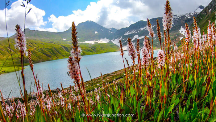
Aptly termed 'The Queen of Lakes', Dudipatsar Lake (also called Dudipat Lake) is located at a height of 3,875 m in the Lulusar-Dudipatsar National Park, Pakistan. Dudipatsar Lake Trek is a great option for less experienced trekkers who want to try longer, multiday treks and also gain some camping experience.
Jump to:
- Hike Overview
- Hike Map
- Trip Overview
- How to Reach
- Hike to Campsite
- Camping
- Hike to Dudipatsar Lake
- The Takeaway
- Equipment
- Trail Video
Hike Overview
- Hike Difficulty: Moderate
- Trail Length : 19 km (12 mi)
- Typical Hike Duration (One-way): 7 to 9 Hours
- Trail Head: Moon Restaurant, Besal
- Besal Height: 3,250 m (10,662 ft) ASL
- Dudipatsar Lake Height: 3,875 m (12,713 ft) ASL
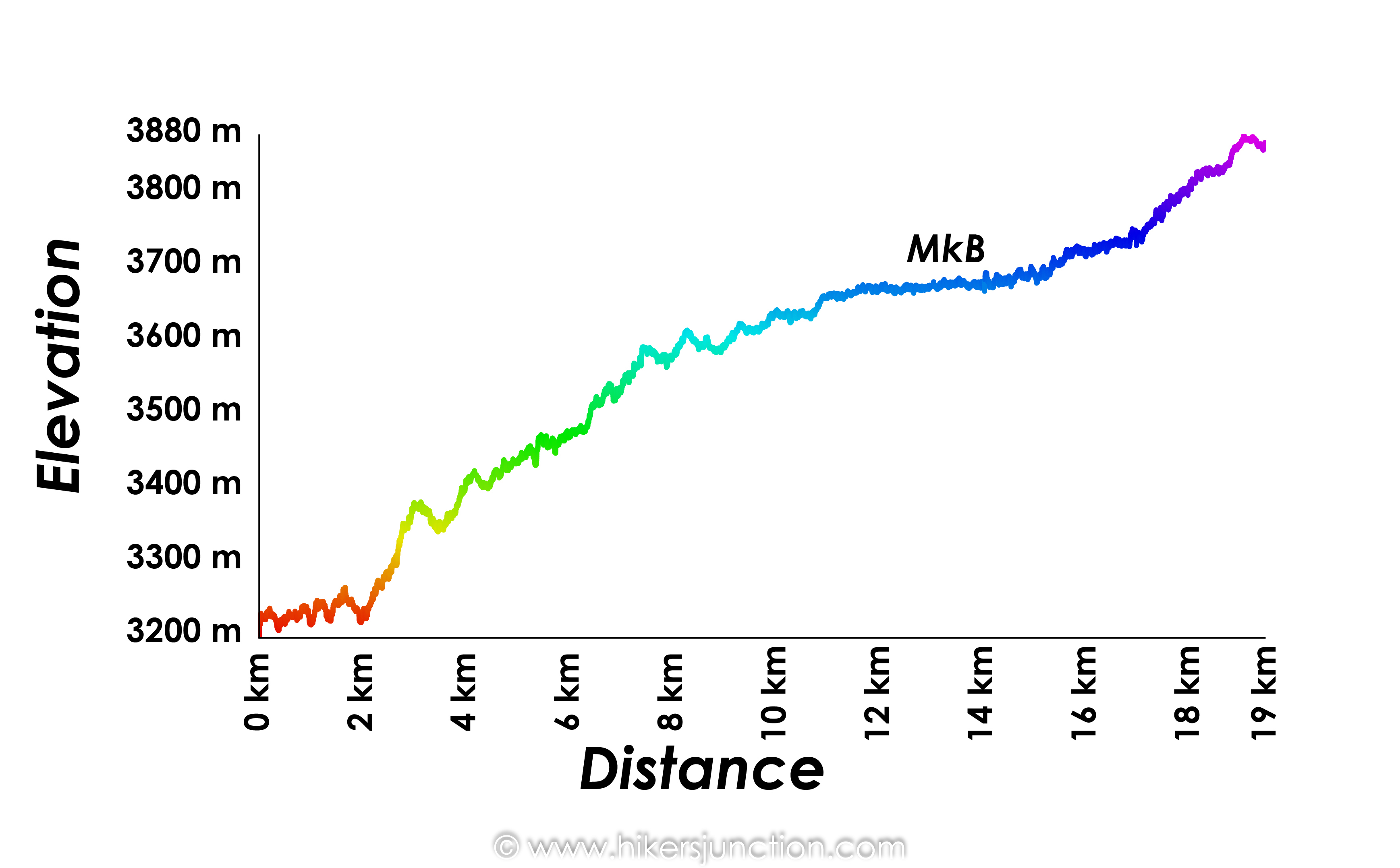
- Elevation Gain: 625 m
- Hike Season: July to September
- Campsite: Mulla ki Basti
- Guide: Available from Besal
- Porters: Available from Besal
- Car Parking: Available at Moon Restaurant, Besal
Note: Preserving nature is the responsibility of every tourist / hiker. Please DO NOT LITTER, DO NOT DRAW GRAFFITI, DO NOT CUT TREES.
Dudipatsar Lake Map
Trip Overview & Itinerary
| Day | Time | Journey | Duration |
|---|---|---|---|
| Day 0 | 05:00pm to 11:00pm |  Islamabad to Kaghan |
6 hours |
| Day 1 | 07:00am to 11:00am |  Kaghan to Besal |
4 hours |
| 12:00pm to 06:00pm |  Besal to Mulla ki Basti |
6 hours | |
| Day 2 | 07:00am to 09:00am |  Mulla ki Basti to Lake |
2 hours |
| 11:30am to 05:30pm |  Lake to Besal |
6 hours | |
| 06:00pm to 08:00pm |  Besal to Batakundi |
2 hours | |
| Day 3 | 08:00am to 04:00pm |  Batakundi to Islamabad |
8 hours |
Reaching Besal
Summer of 2020 wasn't the easiest time to go travelling. After spending months in on-and-off lockdowns, I could not wait to get out into nature once again. The national holiday of 14th August was on a Friday so me and a cousin of mine figured we must make the most of this long weekend. I took Thursday off from work, and at 5pm on Wednesday evening we hit the road towards Dudipatsar Lake.
Dudipatsar Lake's location is between Naran and Babusar Pass. The journey is a fairly straightforward 320km long drive which normally takes around 10 hours.
We drove till 11pm on Wednesday night, reaching the vicinity of Kaghan valley when we decided to crash at a hotel to spend the night. We pulled up at a hotel and got a room for Rs. 1500. The next morning we got up early at 6am and hit the road again. Driving at early morning in the hilly regions is an incredible experience. There is no traffic, the clouds are low and there is serenity all-around. After about 2 hours on the road, we reached Naran where we took a short break.
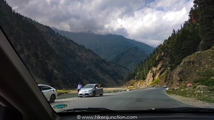
Dudipatsar Lake's distance from Naran is about 50km but it takes around 2 hours due to the many potholes on the road. Eventually we reached Moon Restaurant Besal, which is the starting point of the trek.
Upon entering Moon restaurant's parking area, we told the parking attendant that we are here for the hike to Dudipatsar and he guided us to a specific area in the parking where all the hikers' cars were parked. Parking your car in the same place as other hikers' makes it easy for the watchmen to look after the cars at night. We parked the car and sorted out our rucksacks. Next, we needed a guide who would go along with us. After asking around, we figured that across the road there is a guy who manages guides. We also got ourselves a horse to carry some of our stuff.
Hike to Campsite
In order to start the hike we first had to cross the raging Kunhar River. For this, there is a 'doli', a mini cable car, which takes people and goods across the river. One person sits in the doli and another pulls the rope to take the doli across.
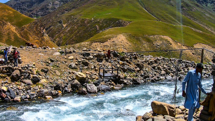
Once across, we waited for our guide. Soon after at around noon time we started our trek. The route is alongside a water stream which comes from the lake. In the beginning the terrain is dry and hence the trail is somewhat dusty. Ironically, the face masks due to Covid came in very handy here.
It was fairly easy to spot the trail up until the several unmelted glaciers that came in the path. On some of these we were supposed to cross over the water stream to the other side whilst on others we didn't. Due to this, it was possible that we could have lost the trail if we didn't have a guide with us.
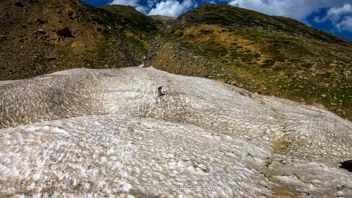
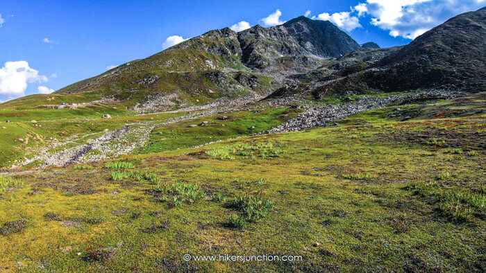
After crossing the last glacier which is particularly tricky due to its steep slope, we climbed up a rocky incline. Once at the top, we ended up in a vast open meadow. From here onwards, the hike has a very gradual, almost unnoticeable, incline all the way up to the campsite. The mountain behind the lake is constantly in sight from this point onwards.
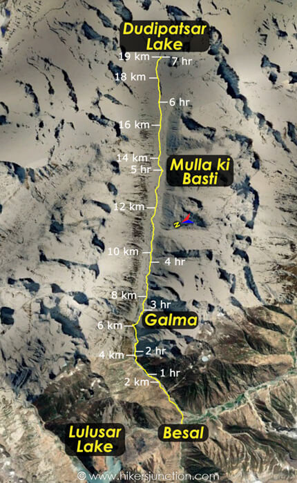
After a little over 7 km of hiking, we reach an area called 'Galma' where some locals sell tea out of a tent.
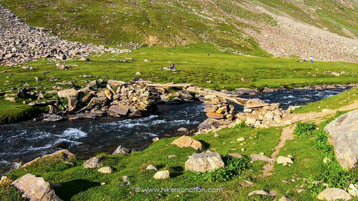
After 11 km on the trail, we had to cross the water stream yet again. This time there was a wooden plank that serves as a bridge. Going over such planks is always fun.
Camping at Mulla ki Basti
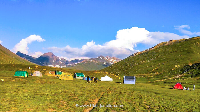
After hiking just over 13 km in just over 5 hours, we reached the small camp site which goes by the name of 'Mulla ki Basti'. This is the designated campsite for this hike. Most people stop here to camp for the night. We brought along our own tent and food but even if we hadn't, both were available here at a price. We set up our camps, pulled out our stove and heated up our preserved food for dinner.
At night time the temperature dropped quite a fair bit. Luckily we had good quality sleeping bags with good temperature rating. The weather at the Dudipatsar Lake trek can change rapidly hence it is wise to be prepared.
Available Facilities at Campsite
| Facilities | Availability |
|---|---|
| Tents |  |
| Water |  |
| Food |  |
| Toilet |  |
| Phone Signals |  |
Hike to Dudipatsar Lake
The following morning, I woke up to a cruel realisation that the battery of my GoPro which I use the shoot my YouTube videos had drained completely. Apparently, in the cold of the night, batteries of electronic devices drain very quickly. Hence, it is recommended to keep your camera, mobile phone and power bank inside your sleeping bag so that they may keep warm and preserve their charge. I did have a power bank on me but my genius had forgotten the charging cable in the car, some 13kms away.
Other hikers at the campsite were just beginning to wake-up. There was a makeshift toilet nearby. I lingered around it for a while, saying hello to everyone passing by and asking if someone had a charging cable I could borrow. Soon enough I had a cable, I hooked it up to my power bank and we were golden again!
After having breakfast, we resumed our trek at around 07:15am. The lake was located a further 6 km away, which would take about 2 more hours along the same path along the water stream.
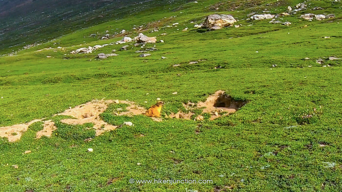
On this stretch we heard and saw the first marmots of the trip. These were about the only wildlife that we saw other than horses.
Just before the final ascent to the lake, the single valley through which we have been trekking splits into two. The one straight up ahead goes to Dudipatsar Lake, and the one to the right goes to Saral Pass and then Saral Lake. Those trekkers who do the Dudipatsar Lake to Ratti Gali Lake trek have to follow this path.
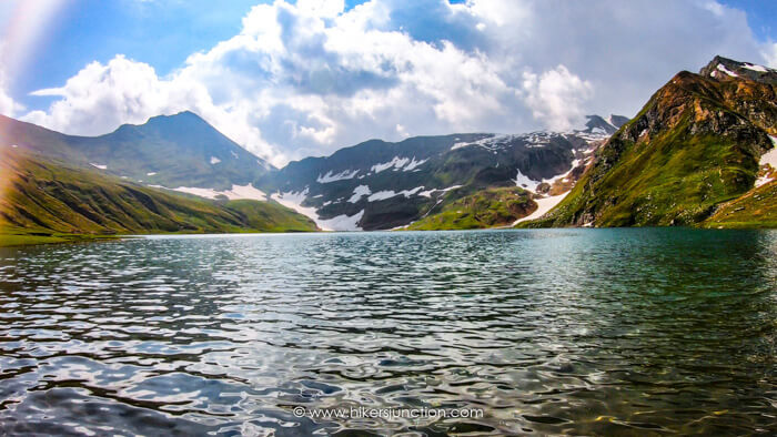
The final approach to the lake consisted initially of a climb and then a gradual descent towards the lake. The beauty of this lake is in the snow on the mountain in the backdrop of the lake. Due to Dudipatsar Lake's height of 3,875 m it gets a lot of snow in the winters and this snow does not usually melt completely in the summer. The greenery combined with the white snow elevates the visual appeal of this lake. Earlier in the hiking season (July) there is more snow and the views are that much better.
If you reach the lake early on a sunny day then the sun would be rising behind the lake and henceforth taking good pictures will be tricky. In the afternoon / evening, however, the sun will be shining onto the lake and the true grandeur of the lake will be on display. If you are staying at the lake till evening, make sure you have warm clothing with you because Dudipatsar Lake's temperature can drop quickly in the evening.
As for ourselves, we spent about 2 hours at the lake before heading back at 11am. We stopped for a short while at Mulla ki Basti for lunch. We packed our tent and headed back. By 5pm in the evening we were back at our car. We drove overnight (not recommended) and reached back Islamabad at around 3am.
The Takeaway
The Good
Dudipatsar Lake is one of the most convenient high altitude lakes to hike to. Reason for this is that you can drive all the way upto the trail head. There is no jeep journey involved, which usually takes a lot of time, costs money and is never comfortable.
The Bad
Littering. I can never understand how people can pollute such a place. Hikers and locals alike are throwing away wrappers and plasic bottles, ruining the area. The most appaling thing to me was when we reached the lake, some people from the day before had left all sorts of wrappers and bottles by the lakeside.
The Dudipatsar and Saral area has also been prone to criminal activities for a while. It is hoped that the security situation will improve so that hikers can visit the lake without any concerns for their safety.
Trail Video
Other Hikes
Check out similar blog posts on many other hikes here.
Equipment
Having the right equipment and gear is essential for an enjoyable hiking experience. Check out the list of recommended hiking gear.


