Hike to Miranjani Peak
23rdJune 2021

Standing at 2,971m, Miranjani Peak is the highest peak in the Galiyat region. It can be summitted in a single day by hiking up the Miranjani hiking track. I climbed Miranjani in June 2021 enroute my hike to Dagri Bangla.
Jump to:
Hike Overview
- Hike Difficulty: Easy
- Miranjani Track Length : 5 km (8.7 mi)
- Miranjani Top Hiking Time (One-way): 2 - 3 hours
- Elevation Gain: 614 m (2,014 ft)
- Miranjani Peak Height: 2,971 m (9,747 ft)
- Water Availability: None
- Trailhead: Miranjani Trek Starting Point, Namli Maira
- Trailhead Altitude: 2,357 m (7,733 ft)
- Guide: Usually available from near the Trailhead
- Porters: Usually available from near the Trailhead
- Car Parking: Available at trailhead
Note: Preserving nature is the responsibility of every tourist / hiker. Please DO NOT LITTER, DO NOT DRAW GRAFFITI, DO NOT CUT TREES.
Miranjani Top Map

Trip Overview & Itinerary
| Day | Time | Journey | Duration |
|---|---|---|---|
| Day 1 | 08:00am to 11:00am |  Islamabad to Nathiagali |
3 hours |
| 11:30am to 02:00pm |  Nathiagali to Miranjani |
2.5 hours | |
| 03:00pm to 05:00pm |  Miranjani to Nathiagali |
2 hours | |
| 06:00pm to 09:00pm |  Nathiagali to Islamabad |
3 hours |
Notable Tip
- There is no water source on the Miranjani hike. Hence, carry at least 1.5 litres of water for the roundtrip.
Reaching Miranjani
Miranjani top's distance from Islamabad is 94km. We set off from Islamabad on Saturday at 8am, taking the Murree Expressway till Dunga Gali. The starting point of the trek can be reached by taking a right just before Nathiagali bazaar towards the governer house and church. We headed past the church and a few turns later we saw the solitary hut which marks the start point. The concrete steps towards the right side of the hut are the Miranjani trek start point.
Hike to Miranjani
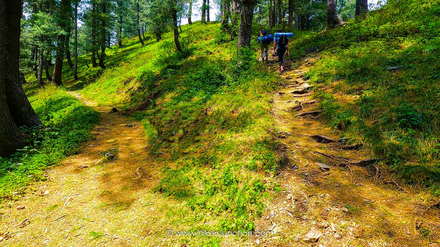
The trail starts off with a few concrete steps leading into the forest. The trail leveled ever so slighlty before becoming steep for the initial 1km of the hike. At the end of this first ascent the trail becomes flat, turning into a pleasant walk through the woods with decent views of the surrounding hills.

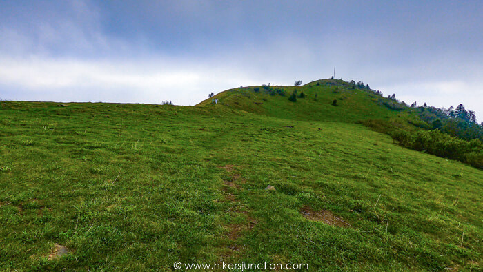
At the first split in the trail we took the path on the right. This path led to the small Miranjani pond. There was also a guy there selling tea and snacks. Miranjani Peak and its iconic steel pillar was visible from this point in the distance straight up ahead.

Around this area there were a bunch of cows. Luckily they were the only wildlife we had to deal with.

As we proceeded into the trail the chirping of the birds becomes more and more noticable and the track became narrower.

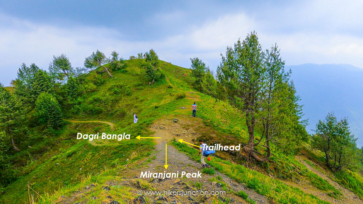
Up until near the very top where there is another split in the trail. The inclined path to the left led to the Miranjani Peak whilst the path straight up ahead was to Dagri Bangla.

From this split it took us about 7-8 mins to get to Miranjani Peak. In total, reaching the peak took us about 3 hours from the trailhead, but it would have taken us lesser time if we weren't carrying rucksacks for camping at Dagri Bangla.

Miranjani's weather can be a little bit unpredictable. As we reached the top, clouds had started to gather and a little while later it started raining heavily. At Miranjani's height, this kind of weather pattern is not unusual. With the rain, Miranjani top's temperature dropped and we had to pull out our jackets.
Miranjani is a great destination for a day hike. If a comparison is to be made between Miranjani top vs Mushkpuri, Miranjani is the longer hike, but it is far less busier. Just like Mushkpuri, many people go to Miranjani top in winter also. Miranjani top height is slightly higher than Mushkpuri hence it gets ample amount of snow in the winter.
Trail Video
Other Hikes
Check out similar blog posts on many other hikes here.
Equipment
Having the right equipment and gear is essential for an enjoyable hiking experience. Check out the list of recommended hiking gear.


