Kashmir to KPK - Ratti Gali to Besal
30th July 2023
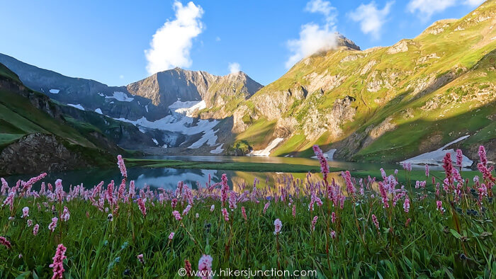
One hike that has in recent years gained immense popularity is the Kashmir to KPK trek, more commonly known as the Kashmir to Naran trek or the Ratti Gali to Besal trek.
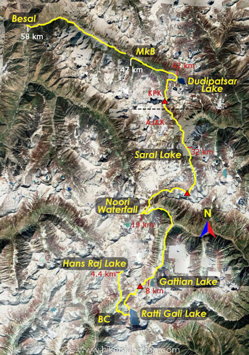
This trek starts at Ratti Gali Base Camp in Kashmir and ends at Besal in Kaghan Valley in KPK. The trail goes through several majestic lakes and 4,000m+ passes across 6 days covering around 60km.
There are a few route variations of this hike. People have done the same trek whilst crossing different passes and visiting different lakes so the itinerary is not fixed.
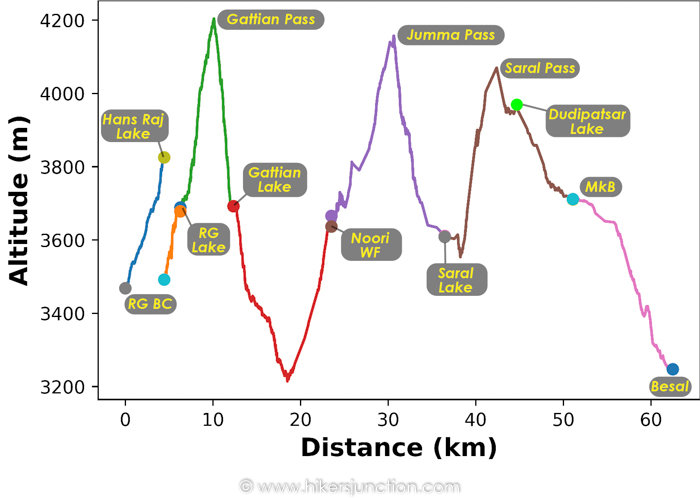
My trek includid visiting Ratti Gali Lake, Hans Raj Lake, Gattian Lake, Noori Waterfall, Saral Lake and Dudipatsar Lake. The passes I crossed were Gattian Pass, Jumma Pass and Saral Pass. Read further the know the story of this thrilling hiking adventure in Pakistan.
Jump to:
- Hike Overview
- Trek Map
- Trip Overview
- How to Reach
- Hike to Hans Raj
- Hike to Gattian Lake
- Hike to Noori Waterfall
- Hike to Saral Lake
- Hike to Dudipatsar Lake
- Hike to Besal
- Trail Video
- Equipment
Hike Overview
- Hike Difficulty: Moderate
- Trail Length: 68 km (42 mi)
- Typical Hike Duration: 40 Hours
- Trail Head: Ratti Gali Base Camp
- Max Altitude: 4,204 m (13,792 ft)
- Hike Season: July to September
Note: Preserving nature is the responsibility of every tourist / hiker. Please DO NOT LITTER, DO NOT DRAW GRAFFITI, DO NOT CUT TREES.
Trek Map
Trip Overview & Itinerary
| Day | Time | Journey | Duration |
|---|---|---|---|
| Day 1 | 12:00am to 08:00am |  Islamabad to Dowarian |
7 hours |
| 10:00am to 12:00pm |  Dowarian to Ratti Gali BC |
2 hours | |
| 02:30pm to 04:30pm |  Ratti Gali BC to Hans Raj |
2 hours | |
| 05:00pm to 06:30pm |  Hans Raj to Ratti Gali BC |
1.5 hours | |
| Day 2 | 08:30am to 09:15am |  Ratti Gali BC to Ratti Gali Lake |
45 mins |
| 09:30am to 05:30pm |  Ratti Gali Lake to Gattian Lake |
8 hours | |
| Day 3 | 10:00am to 03:15pm |  Gattian Lake to Noori Waterfall |
5.5 hours |
| Day 4 | 09:00am to 05:00pm |  Noori Waterfall to Saral Lake |
8 hours |
| Day 5 | 10:00am to 04:00pm |  Saral Lake to Dudipatsar Lake |
6 hours |
| 04:30pm to 06:30pm |  Dudipatsar Lake to Mulla ki Basti |
2 hours | |
| Day 6 | 05:30am to 10:00am |  Mulla ki Basti to Besal |
4.5 hours |
| 02:00pm to 11:00pm |  Besal to Islamabad |
11 hours |
Reaching Ratti Gali Base Camp
Our journey started around mid night in Islamabad. I was part of a group expedition for this trip. All the participants gathered at the rendezvous point and we set off for Kashmir. Our first destination was Dowarian near Keran in AJ&K. The distance of Dowarian from Islamabad is about 245km which takes at least 6 hours to complete. We took the Murree Expressway route for this journey.
After travelling overnight we stopped at Kundal Shahi waterfall for breakfast. Shortly after we reached Dowarian and disembarked from our transport.
Here we jumped into jeeps for the off-road journey to Ratti Gali Base Camp. The jeep journey took around 2 hours. I noticed that compared to 2016, the jeep track had been made wider in certain locations which was certainly an improvement.
Just as we reached the basecamp it started to drizzle a little.
Trek to Hans Raj Lake
As I mentioned, several different routes can be undertaken on this trek. So we had two options to consider.
This first option was to visit Ratti Gali Lake right now and then return to base camp. The next day we would then visit Hans Raj Lake, Kala Sar Lakes and then head onwards to Gattian Lake.
The second option was to visit Hans Raj Lake now and return to base camp. The next day's route would be to Ratti Gali Lake and then Gattian Lake, skipping Kala Sar Lake.
The second option was selected and consequently we headed out towards Hans Raj Lake. Kala Sar Lake is a relatively small lake so we weren't too fussed about missing out on it.
The trek to Hans Raj was a very good aclimitising trek. Considering that the next day we would climb up to 4,200m, it was useful to get used to some altitude the day before.
The trek to Hans Raj Lake was about 4.5km covered in about 2 hours. We gained 360m of altitude reaching up to 3,825m. I was surprised to realise that Hans Raj Lake was in fact higher than Ratti Gali Lake itself.
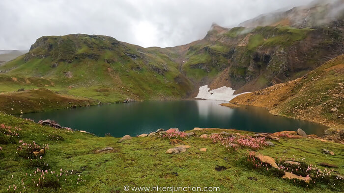
After spending a little while at the lake we headed back to base camp. Staying at the base camp was not very pleasant at all. The entire base camp area was muddy due to the rain. On top of that, because a lot of people visiting Ratti Gali Lake rely on mules, there were a lot of mules at the base camp and hence there was mule excrement all over the place. So walking around the base camp was really frustrating.
Trek to Gattian Lake via Ratti Gali Lake and Gattian Pass
The following morning we packed up our rucksacks and moved towards Ratti Gali Lake. It was peak season at Ratti Gali so a lot of tourists were on the trail, many of them on mules. Because of all the mule traffic, the entire trail was once again covered in mule excrement. Luckily, we only had to bear this for about 45mins, after which there would be absolutely no one except our group.
My rucksack which I was carrying was packed for 6 days in the wilderness. Obviously this made me slower than someone who wasn't carrying any weight. The passing-by 'Ratti Gali' tourists looked at me in amusement as to why was I carrying all this gear just to go to Ratti Gali, which they were doing in skin-tight jeans and moccasins. One of them amusingly asked me where I was going, I responded with "Naran". He looked at me bewildered, probably thinking either I was a fool or I was tring to make him a fool.
In about 40 odd minutes I reached Ratti Gali Lake. This was the second time I saw this lake, the first time being back in 2016. The lake was just as breathtaking now as it was then.
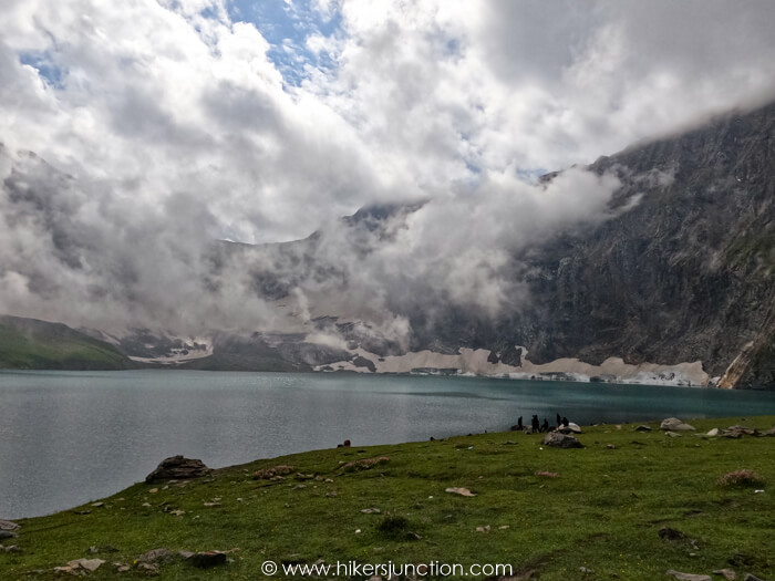
After a short break, we moved on from Ratti Gali Lake towards the left side and started gaining altitude. Our first target was Gattian Pass, on the other side of which is Gattian Lake. There wasn't a distinct trail anymore since this trek isn't done a lot. We mostly moved on paths made by cattle. The day was cloudy due to which visibility wasn't great, otherwise we would've gotten some amazing views of Ratti Gali Lake from height. Hans Raj lake could've also be seen from a distance. The clouds were a blessing as well because otherwise in the sun it gets very hot and the skin burns due to the altitude.
We carried on gaining altitude, moving through blue flowers growing on the slopes.
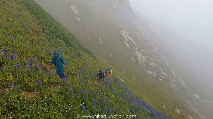
As we got higher, the flowers and greenery made way for rocks and boulders. Soon after it started raining heavily. We pulled out our waterproofing layers.
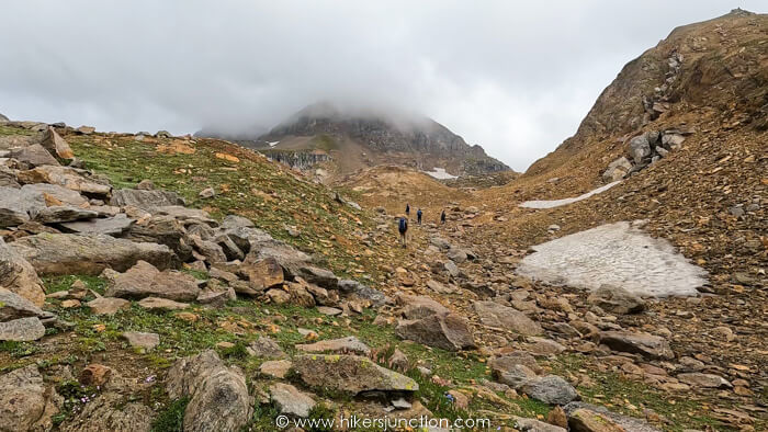
Our group had to stop many times and take prolonged breaks due to some very slow group members. There was only 1 guide for the whole group which meant he had to take everyone along. Standing around in the pouring rain at almost 4,000m waiting for other people wasn't fun at all.
The visibility got really bad in this process but we finally made it to Gattian Pass (4,204m). The gruelling ascent had finally come to an end. We now had to descend down to the lake but not before crossing some snow.
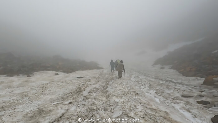
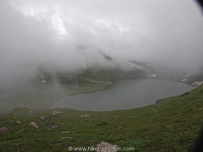
Gattian Lake comes into view quite a while after crossing the pass. In clear conditions, it is a sight to behold. But unfortunately for us, the weather did not give us that privelege. Nonetheless when we were in range to view the lake, occassional fog clearings made it possible to gaze upon it for short durations.
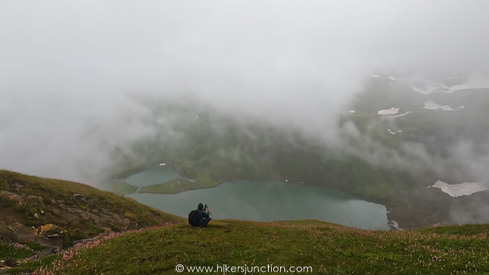
We carried on and got a few more views of the lake before reaching its base where the porters had already set up camps and cooked a small snack for us.
The next morning we woke up to a perfectly clear day. We could see this wild lake in all its glory. We also saw the path we came down from and thanked God that we weren't doing this trek in the opposite direction.
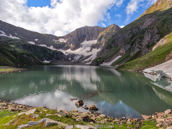
We spent a few hours of the morning by the lake, exploring the lake's shores, taking pictures and basking in the sun after being wet all day yesterday.
Trek to Noori Waterfall
After having breakfast by the lake, we set out to Noori Waterfall at around 10am. This day's trek was somewhat opposite to previous day in terms of the elevation profile. We were to first descend down to a valley and then climb up the other side. We set off from the right side of the lake's outflow. A little while later the descend started, offering great views of the valley below.
We carried on trekking till we could see the Jhalkad-Sharda jeep track (also called the Noori top jeep track). Just before the road we had to cross over a rather slopey and slippery glacier. Across the glacier were a few huts of locals right beside the jeep track.
This was the lowest point of the day's trek, after this we started climbing up the road. The road section was about 1.5 hour long for those who walked whilst others hitched rides here. The road section was really tiring for me, walking on a public road (albeit a remote jeep track) is just not the same as hiking on a trail.
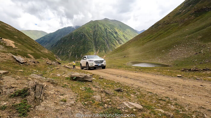
The next major water crossing was coming from the Noori Waterfall, so we promptly turned off the road and headed up. As we moved forward on the right side of the water, we came across several 'waterfalls' on the Noori stream. We reached the last plateau and could see the actual Noori waterfall in the distance. This one was larger than the ones we had seen previously, but it was also quite further away from where our camps were being setup.
This was a relatively easier day, trekking only about 5 hours through relatively lower altitudes, but I felt quite drained by the end of it. From the campsite some people took an excurison to Noori lake which was another 2-3km and 200-300m elevation gain. I chose to not join in on this trip.
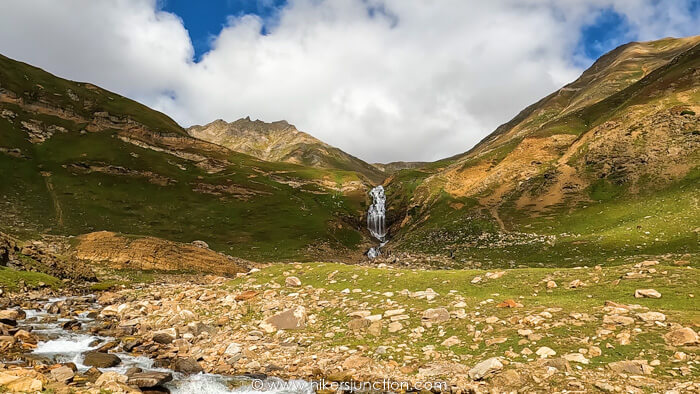
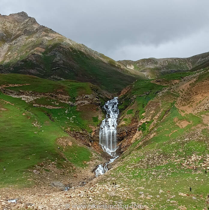
Trek to Saral Lake
The next day was a big one and probably the climax of the trip. This was the day we cover the most amount of distance, cross the notorious Jumma Pass and reach the even more notorious Saral Lake. This was also the day I was most concerned about, but more on that later.
We set off at around 9am, rejoining the road at a higher intersection and then crossing over it. We gradually gained altitude and made our way towards Jumma Pass. Jumma Pass was mentioned a lot during the trip, it was supposedly a tough pass to cross.
After about 3 hours on the trail we were at the base of the pass. There was an unnamed lake to our right. We started the final stretch of Jumma Pass and honestly it wasn't nearly as bad as everyone had made it out to be.
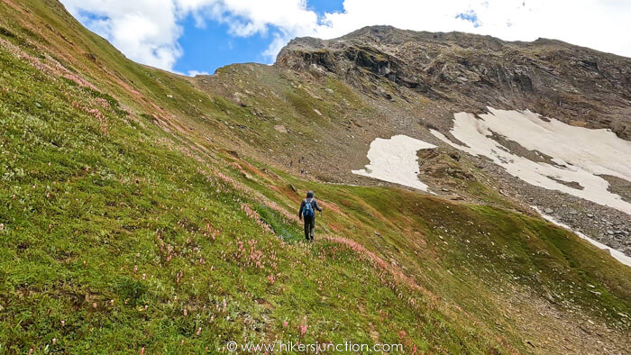
The final push took about 1 hour at the end of which we were at the top. The relief of conquering Jumma Pass was however shortlived. Whilst we were stopped at the pass, waiting for the rest of group to join, some people spotted an animal on a nearby ridge. We were at about 4,100m and the ridge was even higher than us. Not a lot of animals are found at such height.
As we were about to start our descend towards Saral Lake, we heard what I was concerned about the most. Gunshots. A few moments later we heard even more and louder gunshots, but this time it was us. The organisers were carrying pistols and they fired aerially as a response to the initial fires.
Now to put some context to this, the area surrounding Saral and Dudipatsar Lakes has a history. There are some criminal elements in this region since long, commonly referred to as 'Kohistani' or 'Chilasi'. Chilas is not too far from here and apparently these people come over the mountains to target trekkers. Many stories have been told about people getting robbed by these gunmen in this region. This criminal activity peaked the year before when a man lost his life here. What is told is that some trekkers were camped somewhere near Saral Lake. At night time some gunmen approached the camp. Shots were fired and an elderly trekker was killed. This led to police being deployed on the Besal side, not allowing anyone on this trek.
So the animal that was spotted earlier was probably a mule/horse, accompanied by humans. Those humans probably thought that 'we' were the Chilasi's and hence fired those shots to warn 'us' to not come over. Or maybe those people were the Chilasi's, checking to see what we'll do in response to the shots and to see whether we are armed. The reply gunshots conveyed the message that we were indeed armed so it was probably not worth their while to try to target us.
So, we carried on, although very nervously, crossing the big glacier on the other side of the pass.
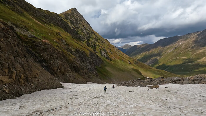
After crossing the glacier we sat down yet again to wait for the slow members, just like at Gattian Pass. After sitting idle for over an hour we carried forward and finally set our sights on Saral lake in the distance for the first time. This was a big moment as Saral Lake was kind of the main destination of the trip.
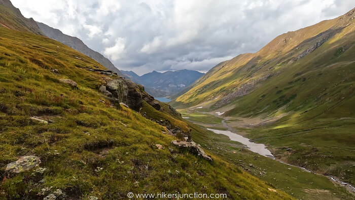
We carried on forward and reached the edge of the lake. There were a few shepherds around who I was looking at suspectfully because of the situation. We trekked along the very long Saral lake for about 20 mins before reaching its opposite side where our camps were being setup.
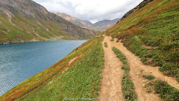
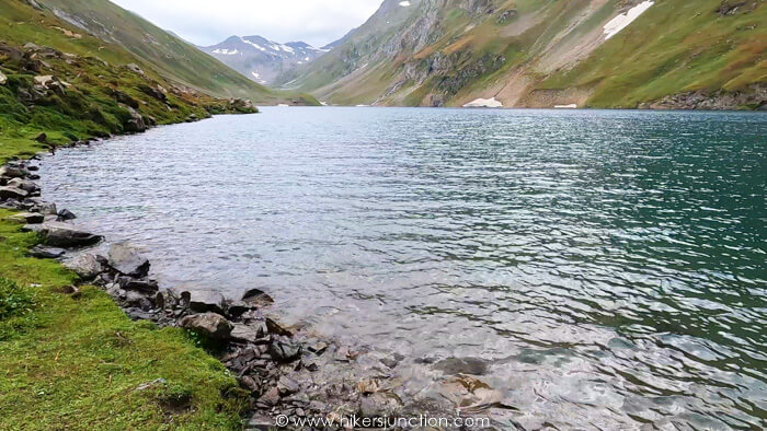
It was almost sunset when we reached the lake. That night I went to sleep hoping dearly for an eventless night.
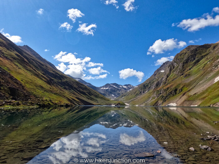
Luckily that wish was granted. The next morning the group spent some time by the lake. Some people went boating in the lake on the inflatable boat that the organisers brought along them.
Trek to Dudipatsar Lake via Saral Pass
Around 10am the group set off once again, this time to cross the final pass of the trek. The destination for this day was Mulla ki Basti after crossing Saral pass and Dudipatsar Lake.
The elevation gain in all of the pass crosses was only around 500m or so. This is not a lot by any means, even Islamabad's Trail 3 is about the same elevation gain. But because the starting altitude is already ~3500m, gaining even 500m becomes quite difficult.
After we had gained a few hundred meters we could see Saral lake every time we turned around. I must say that seeing the lake from above is quite a sight.
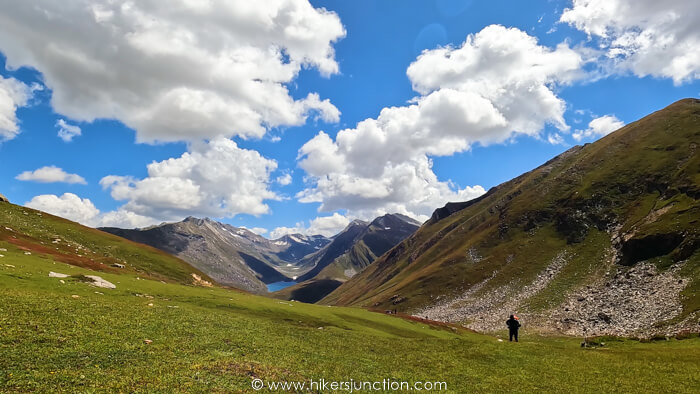
After about 4.5 hours we reached Saral pass. There was officially no more ascent left for this trek. We took one last look at Saral lake before crossing the pass and heading down towards Dudipatsar lake. The intial part of the descent was a bit treacherous with loose rocks on a very steep slope. Once we crossed the rocky portion we started turning towards the right to head into the direction of Dudipatsar. I had been to Dudipatsar before so I felt more familiar with this area.
At around 4pm, after a 6 hour trek we reached Dudipatsar lake. Since it was late summer, the snow behind Dudipatsar had almost completely melted by this point. Without the snowy background and after having seen such greats sights of Saral and Gattian lakes, Dudipatsar honestly didn't look like much. So, after a short rest, a few of us bid adieu to the lake and carried forward to the final campsite at Mulla ki Basti.
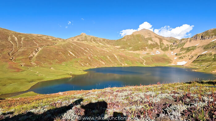
It had been a long day, and quite a long trekking trip by this time. I was feeling quite tired. I could see Mulla ki Basti right up ahead, and I knew I had already trekked this section before. Even though Mulla ki Basti was straight up ahead, the trail however was winding. There were lots of swamp patches scattered all about which the trail navigated around. Due to my tiredness, I made a disastrous decision to not follow the trail but rather follow a straight path to save some distance and time. But this meant I had to watch my step carefully as to not step into a swamp. But turns out that is easier said than done.
I stepped onto what I thought was solid ground because there was a bit of grass growing on it, but it turned out to be anything but, and my foot went straight in till about my knees. I took another step hoping to hit solid ground this time so I can pull my other foot out but that foot went deep in as well. I was stuck. There were only 2 people near me at the time but they were far ahead and darkness was fast approaching.
Both my legs were jammed in the swamp which felt like quicksand. I had a heavy rucksack on, and I was exhausted. The sudden panic triggered my adrenaline rush and I gave everything I had to get out. I used all my strength to move forward whilst trying to pull myself out. A few moments later I luckily managed to get out. My heartbeat had skyroketed and I layed down for a good 10mins to catch my heartbeat and my breath. My clothes had gotten all dirty, heavy and really smelly. I got back to the trail, and dragged myself to Mulla ki Basti. I dropped my rucksack outside my tent and went to stand inside the ice cold river to clean my clothes. I vowed then to never leave the trail again.
Trek to Besal
The next morning we had to get up at around 3am to start packing up for the last leg to Besal. The night was really cold, perhaps because September had rolled around and also due to the fact that Mulla ki Basti was the highest campsite of the trip. After packing up, we set off for Besal at around 05:30am. It was quite dark at that hour so our head torches came in real handy. For the first time we observed frost (kora) on the grass because of the cold. As the sun came up and the altitude decreased, the severe cold quickly transitioned into severe heat.
Finally at around 10am I saw the famous doli of Besal and could see our transport waiting for us on the other side. After dropping my rucksack in the vehicle and resting or a while, I headed to Moon restaurant to wash off 6 days worth of dirt and to grab a snack. Once the entire group had completed the trek, we sat in the bus and headed back to Islamabad.
Trail Video
Other Hikes
Check out similar blog posts on many other hikes here.
Equipment
Having the right equipment and gear is essential for an enjoyable hiking experience. Check out the list of recommended hiking gear.


